
Overview
The UNSW Water Research Laboratory (WRL) is a world-leading fundamental and applied research organisation, specialising in the areas of coastal, environmental, nature-based solutions, hydrology, water resources, hydraulics and groundwater.
WRL is one of the only organisations in the Oceania region with large-scale laboratory spaces and expertise to provide commercial physical modelling services. The specialist equipment and knowledge enable the coastal engineers working here to collect real-world data and analyse it to solve real-world problems.
The Task
Within WRL there are four facilities that use the same range of instruments and operating procedures:
- 0.9 metre wave and open channel flume.
- 1.2 metre wave flume.
- 3 metre wave flume.
- Wave basin.
The coastal engineers using these facilities required a software application to:
- Calibrate each instrument, store the calibration data against the instrument’s serial number and apply the calibration in real time during data acquisition.
- Define instrument configurations and an array of parameters for data acquisition through a user-friendly, yet foolproof interface.
- Acquire data for extended periods of time. Allow for data to be sampled at different rates for each instrument type. Perform data processing and analysis, both in real time and at postprocessing stages using complex algorithms.
- Display and store to disk both raw and processed data in user defined formats.
- Where present, drive the movement of a paddle to generate waves according to a predefined motion pattern and synchronise the paddle motion control signal with the data acquisition.
The application architecture needed to be flexible to allow for new experimental facilities, instrument types and data processing algorithms to be added at subsequent stages of the development without modifications to the structure of the existing application.
The Outcome
NI LabVIEW and data acquisition hardware were selected to facilitate the rapid development, deployment and integration of a flexible and configurable system.
An object-oriented based architecture was deemed best suited for the task. The classes developed within this architecture are designed based on the functions they perform: sensor calibration, data acquisition, motion control, data processing and analysis.
A high-level diagram of the architecture is shown below:
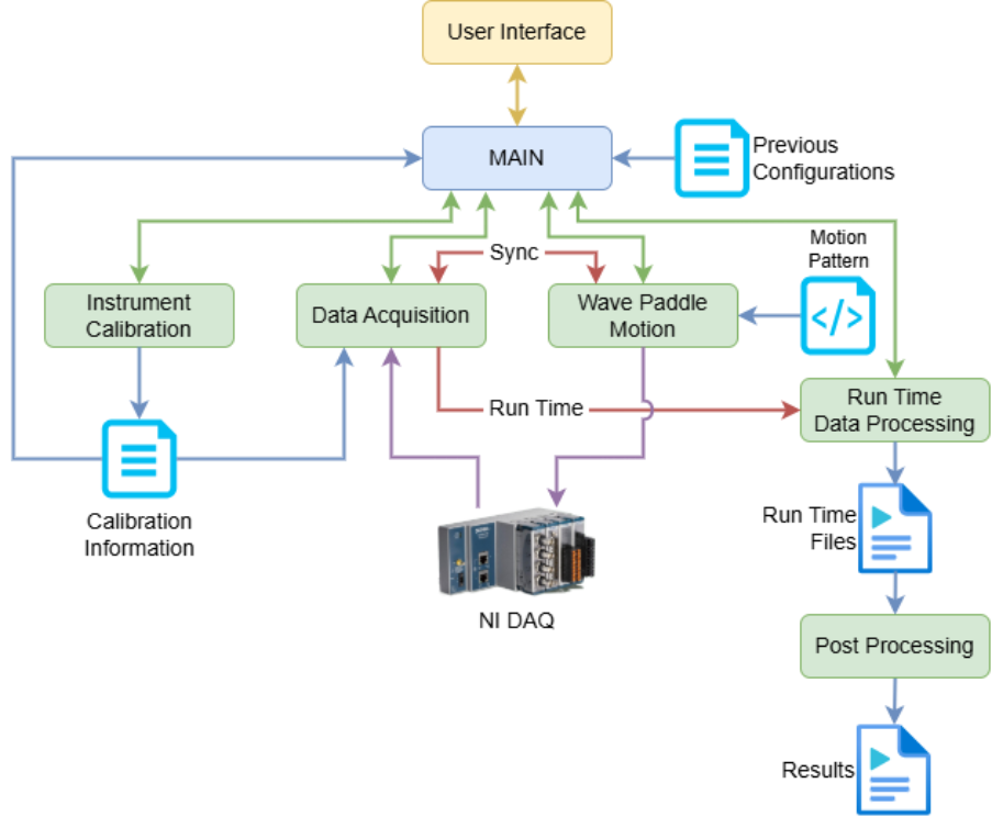
Figure 1 – Software High Level Architecture Diagram
One of the projects where this application enabled a successful outcome was the replication of extremely complex coastal and hydraulic processes through wave flume modelling at Ohau Point in New Zealand. A scale section of 150 m of coastal road, fronted by complex reef bathymetry was tested in the 3 metre wave flume. The modelling investigated waves and overtopping processes to help improve safety at the turbulent site. Modelled options included crown walls (with extreme wave loading) and concrete armour units (detailed placement and stability assessment).
More descriptions of the research projects are shown on the Coastal physical modelling page of the WRL website.
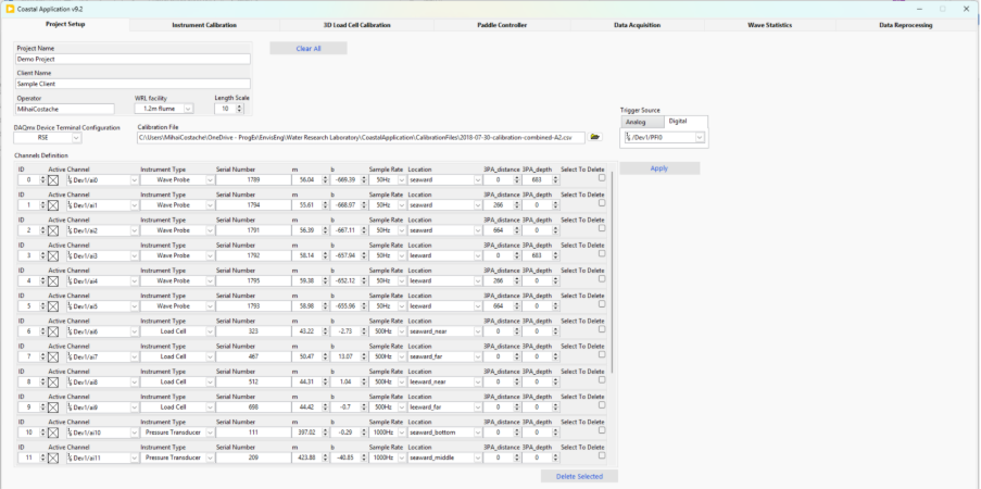
Figure 2 – Project Setup Page
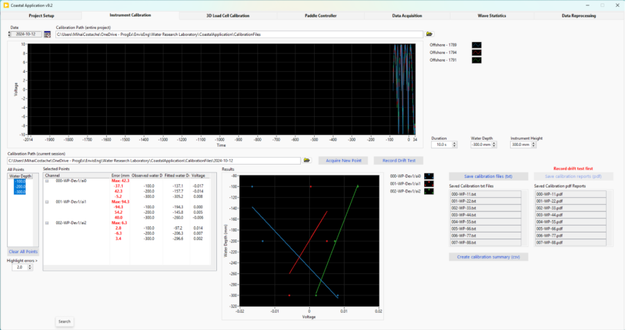
Figure 3 – Calibration Screen (dummy data)
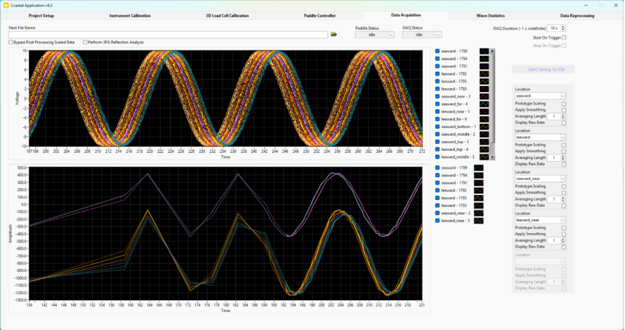
Figure 4 – Data Acquisition Screen (dummy data)
Links: